Bruxelles Port de Mer - ASBL
Association of Merchants and Residents of the Fish Market and St. Catherine (stcath)

Bruxelles Port de Mer - ASBL
Association of Merchants and Residents of the Fish Market and St. Catherine (stcath)
History
Why this name? When the covered market in Brussels first opened for business on the site of the former fish market (on Rue des Halles), the other market traders found it extremely difficult to work alongside the very strong smell of fish. Therefore, from 1884 to 1955, the fish market was set up in the first half of the former dock, and eventually gave the place its name. The area has a rich history, but this can be hard to appreciate due to Brussels’s “moving monuments syndrome”. What is this exactly? Often (some would say too often), major construction works have taken place in the city and shoved its historical heritage aside. Monuments were not always destroyed however, and in some cases they were simply moved to another location.
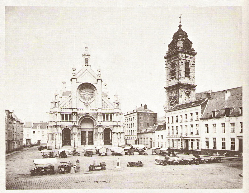
For example, one end of the fish market is dominated by the fountain built in honor of mayor Jules Anspach - but it used to be located in Place de Brouckère. Dismantled during construction of the metro in 1973, it was rebuilt here in 1981. However the fountain was too heavy because, at its new home too, further metro construction was being planned. It was therefore rebuilt without its massive stone pedestal. And also St. Catherine’s Church, at the other end of the fish market, is a replica of the original which used to be found further away on the street of the same name.
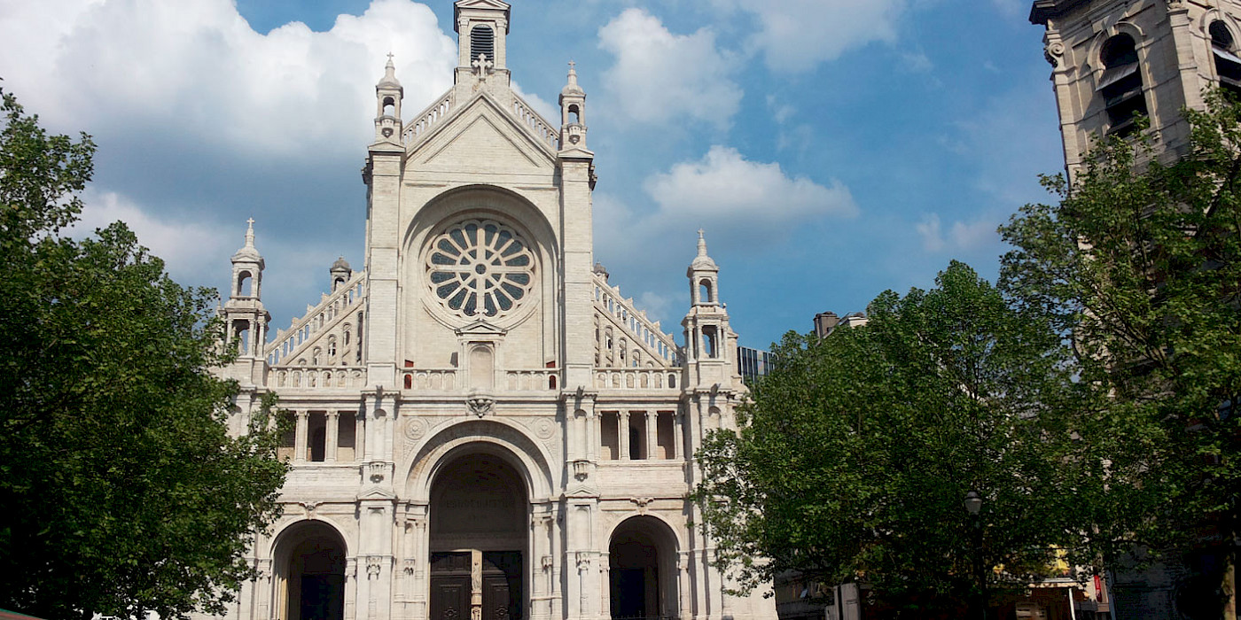
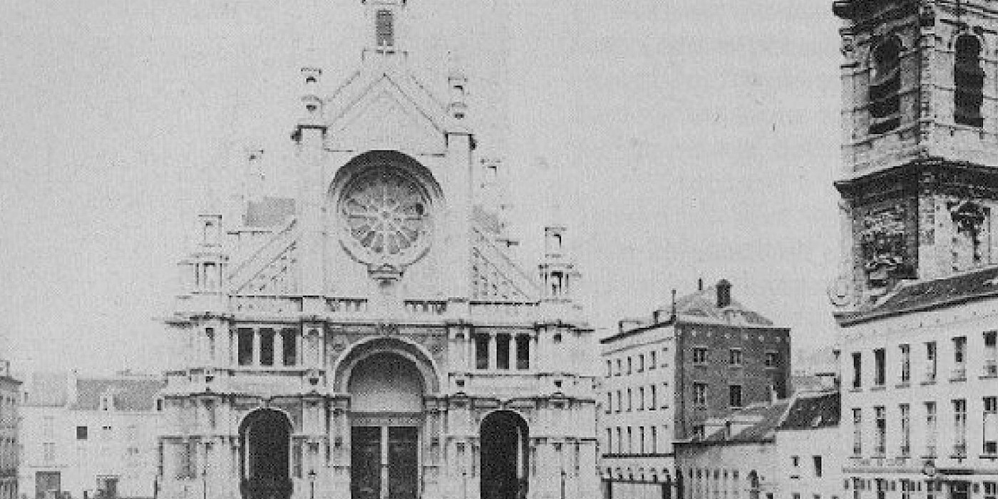
Both these monuments (and there are more examples) are authentic, but none of them are in their original locations except for the two towers in front and behind the new church: the tower belonging to the former church and the Tour Noire (Black Tower), a remnant of the city’s 13th century ramparts. The new St. Catherine’s Church was designed by Joseph Poelaert, the architect behind the Palace of Justice, when he was still working for the city. This building is the result of a typical “Belgian compromise”: despite its Gothic proportions, as requested by Catholic groups, the church’s general architecture was kept much more austere in order to please the city’s liberal government.
An introduction to St. Cath
Below you can find a walking tour that shows the history of the neighborhood by art and old pictures. We hope you enjoy it and be sure to enjoy a refreshing drink at the end on one of our many terraces!
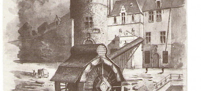
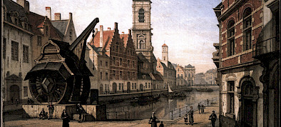
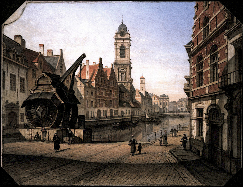
This drawing is on display on the first floor of the Maison du Roi, the City Museum, in the Grand-Place. It depicts the great crane found to the north of the Sainte-Catherine basin, near to the black tower. This ingenious system enabled a hoist to be operated by way of two huge wheels with running boards. Boats that brought in very heavy items such as grindstones or barrels of wine had to navigate to the end of the Sainte-Catherine basin, as it was the only place where they could be unloaded.
Extrication of the black tower
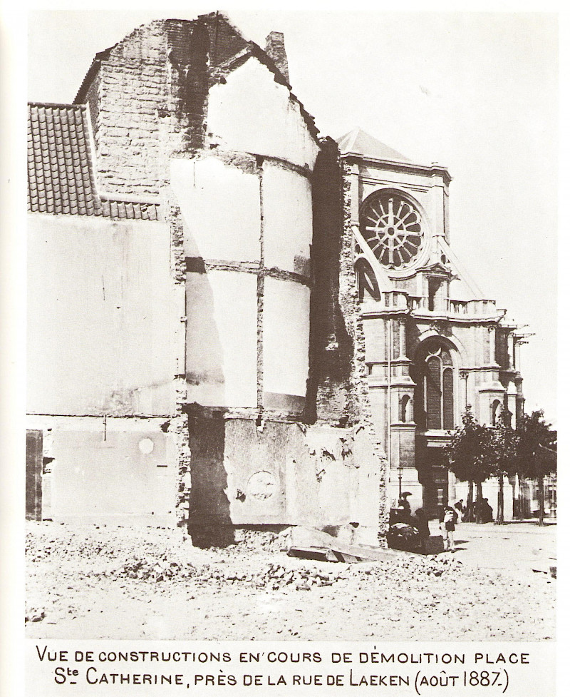
The first wall dating from the early 13th century has left many more traces than the second constructed in the mid-14th century. The latter was systematically dismantled on the orders of Napoleon. The only part that has survived is the Halle Gate. The first wall was integrated at many points into the later building. At the end of the 19th century, an entire tower was extricated behind the Church of Sainte-Catherine. Thanks to Mayor Charles Buls, the tower was saved and restored. Since a new restoration in the late 20th century, it is rather white in colour, but we probably won't have to wait long for its black patina to return.
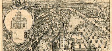
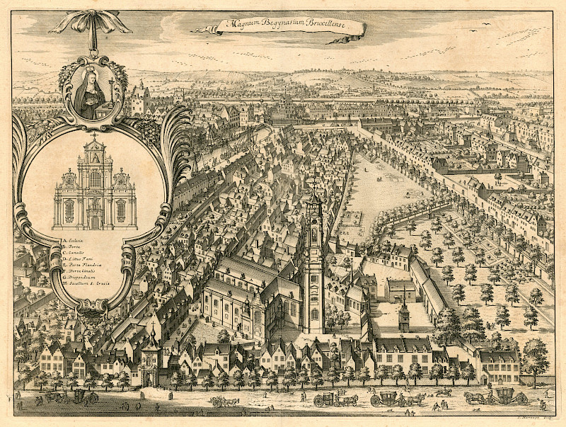
Unlike nuns, Beguines rejected the vow of poverty and were permitted to walk away from their vows of chastity and obedience. The male clergy were suspicious of these independent women and they were persecuted throughout Europe. But in our highly urbanised regions, this typically urban movement grew to such a size that it could no longer be wiped out. In the mid-13th century, the political and religious authorities agreed that the Beguines could keep going as long as they gathered in Beguinages. The Great Beguinage of Brussels and the Beguinage of Mechelen were the two largest communities in existence.
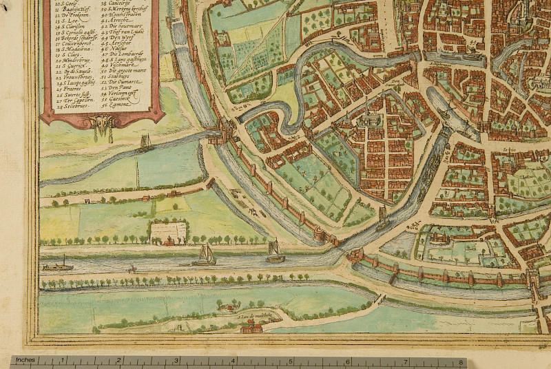
Braun and Hogenberg
The panoramic map created by the engraver Hogenberg for Canon Braun's atlas was published in 1576. This extraordinary document depicts the city looking from west to east. On this fragment, we can see the Great Beguinage, as well as the Willebroek Canal and its basins that had only been built fifteen years earlier.
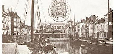
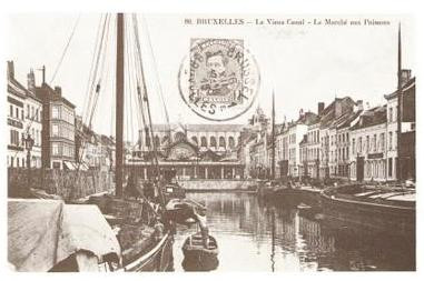
The Sainte-Catherine basin was the first to be filled in the mid-19th century. Between 1854 and 1874, the new Church of Sainte-Catherine was constructed on the site of this basin. The first architect involved in the work was Joseph Poelaert. From 1861, all of his energy was devoted to the Palais de Justice and Wynand Janssens took over at Sainte-Catherine.
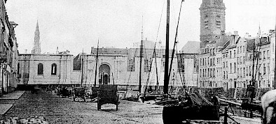
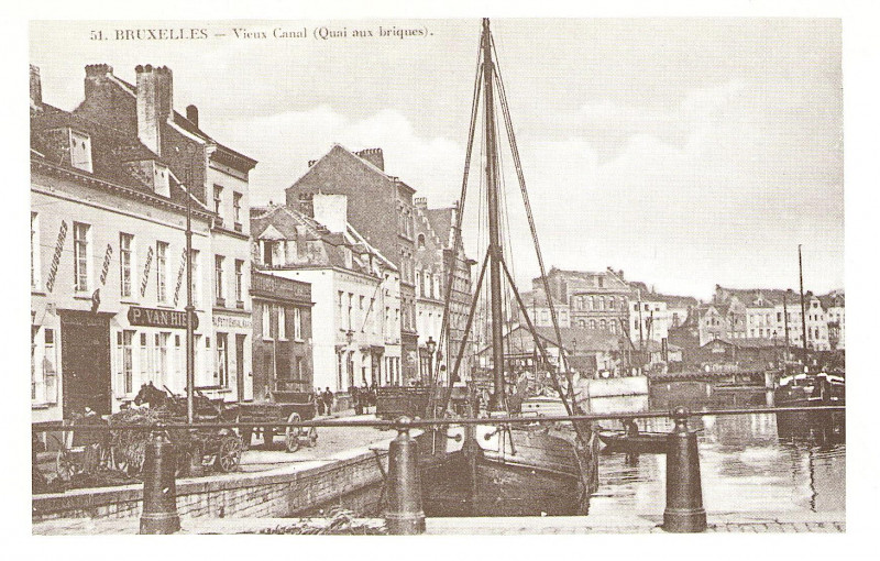
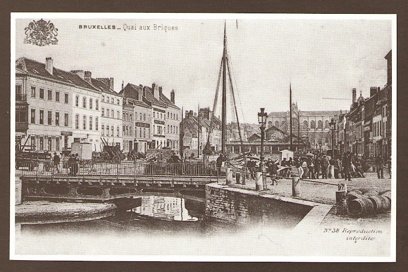
This photo shows the west side of the Quai aux Briques. In the middle of this part of the docks, you can see the entrance to Rue du Pays de Liège. In the foreground is a balustrade that marks out the part of the basin that has been filled in, where the fish market is located.
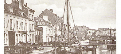
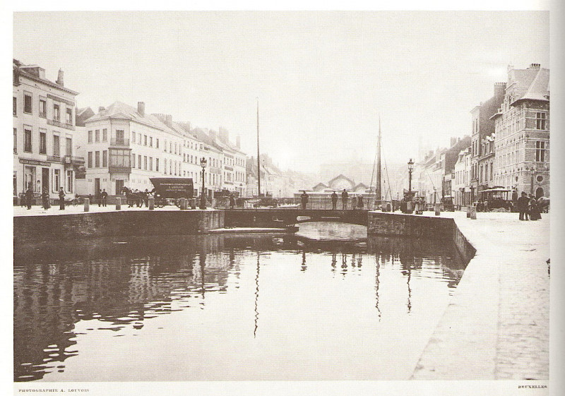
This photo from 1908 is the twin of photo no. 3. It shows the Quai aux Briques, which faces the "Quai aux Briques" comment. This photo shows the Quai au Bois à Brûler [sic] opposite the Quai au Bois à Brûler. In the foreground is the part of the Marchands basin, not yet filled in, behind which is the fish market and the Church of Sainte-Catherine, constructed where the first basins were filled in.
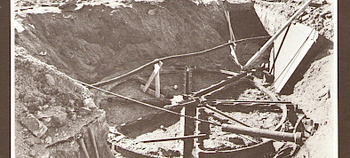
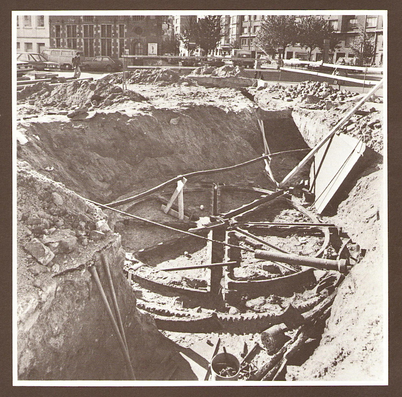
The large cast iron wheel that operated the swing bridge at the end of the Marchands basin was buried during the work to fill in the basins. During the metro construction works and rebuilding of the fountain in honour of Mayor Anspach, it was rediscovered. At the back, you can see the ground floor of the Cheval Marin, at the end of the Quai aux Briques, and to its right the pig market. It was impossible to keep the wheel in this location, so the decision was made to move it to its current home.
Unlike the "Quai aux Briques" comment, this photo shows the Quai au Bois à Brûler opposite. The external appearance of the building, on the corner of Rue du Grand Hospice, has not changed since. In the foreground is a swing bridge, behind which is the fish market and the Church of Sainte-Catherine, constructed where the first basins were filled in.
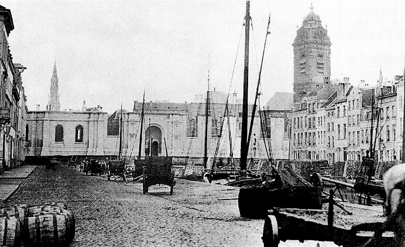
The Marchands basin, the fish market and the Church of Sainte-Catherine
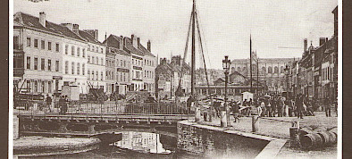
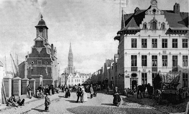
This panorama shows, in the foreground, the Barques basin separated by a swing bridge from the eastern part of the Marchands basin, which has not yet been filled in. In the background is the fish market, occupying the site of the western part of the already filled-in Marchands basin, and the new Church of Sainte-Catherine. Today, the entrance to Rue du Grand Hospice (on the left) has retained its original appearance, and the Cheval Marin (on the right) has returned to its former glory. In the photo, the Quai aux Barques in the foreground is overflowing with the construction materials unloaded there.
This painting by François-Antoine Bossuet can be seen in the Town Hall. It dates from 1888 and depicts an earlier setting. The building on the right, the Cheval Marin, dates from 1680. After it was demolished, its reconstruction was instigated by Mayor Charles Buls right at the end of the 19th century. The delightful construction on the left is the Maison aux Barques where passengers would buy their tickets for the boat. It had already disappeared from the urban landscape by 1830.
The pig market alongside the Cheval Marin
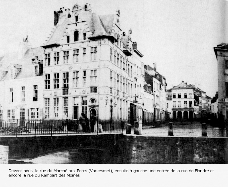
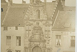
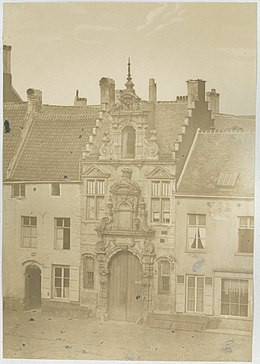
This photo shows the Cheval Marin as it was constructed in 1680. The current building, which recently underwent a stunning restoration, is a copy of the original. After it was demolished, its reconstruction was instigated by Mayor Charles Buls right at the end of the 19th century. In the background of the photo, you can see that Rue Léon Lepage does not yet exist and that the pig market continues down Rue du Rempart des Moines.
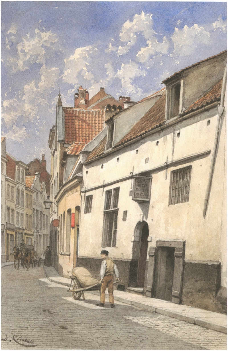
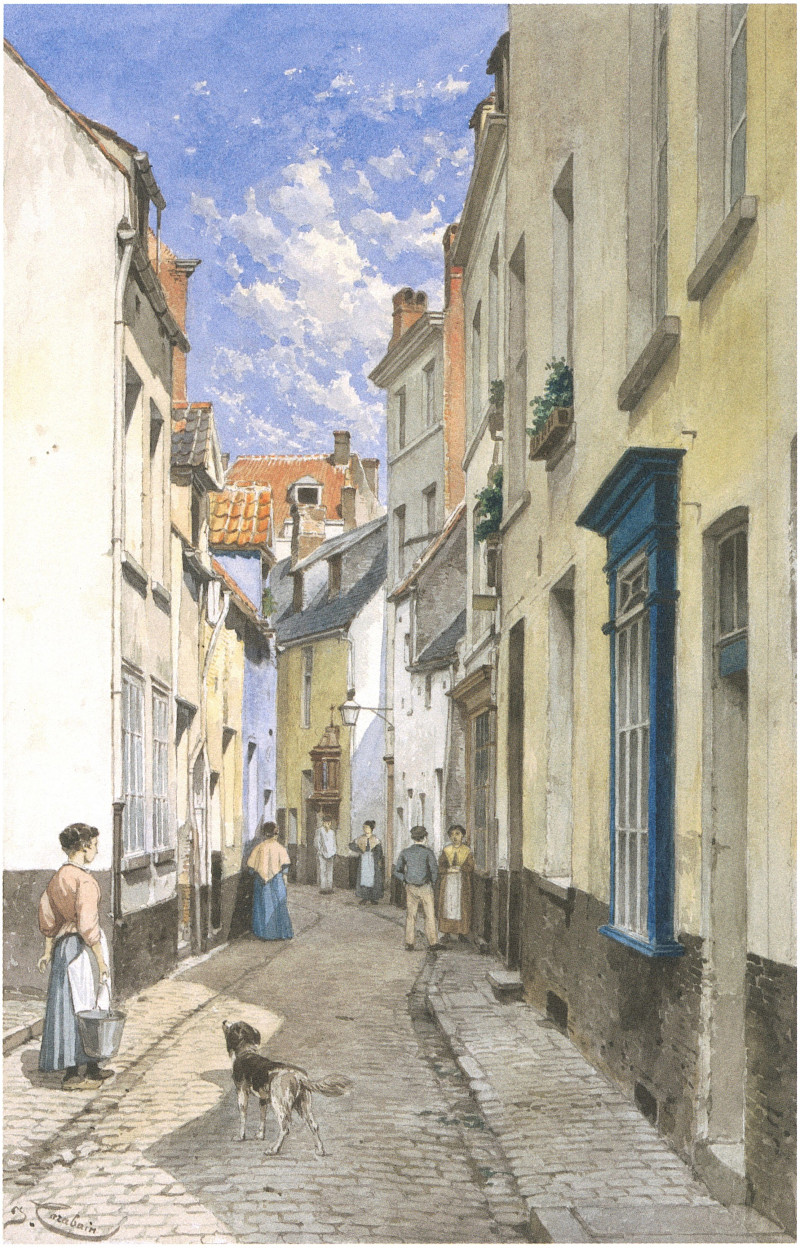
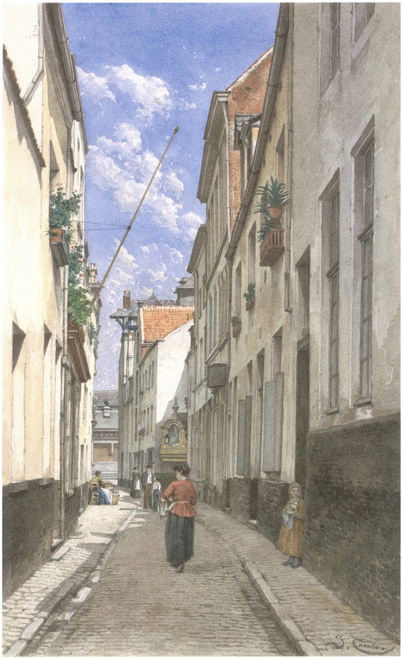
This watercolour by Jacques Carabain dates from 1897 and depicts the entrance to Rue du Rempart des Moines, past the crossroads with Rue de Flandre.
This Jacques Carabain watercolour dates from 1897 and depicts Rue du Pays de Liège with its old Saint-Roch Chapel. As you can see, this chapel, which had been removed, was reinstalled in a new location.
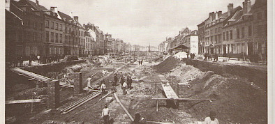
After the Sainte-Catherine basin was filled in, the eastern half of the Marchands basin was also filled in so that a new fish market could be constructed between 1882 and 1884. On the right you can see the Quai au Bois à Brûler, on the left the Quai aux Briques.
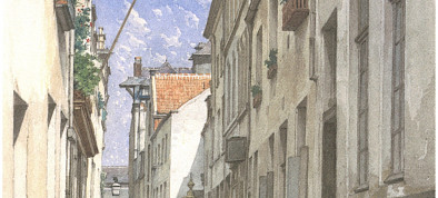
This Jacques Carabain watercolour dates from 1897 and depicts Rue du Chien Marin, as seen from Rue de Flandre looking towards the Quai aux Briques. In the background, you will notice the lateral façades of the fish market and, in the centre, on the right-hand side of the road, the old Saint-Roch Chapel.
Rue du Chien Marin
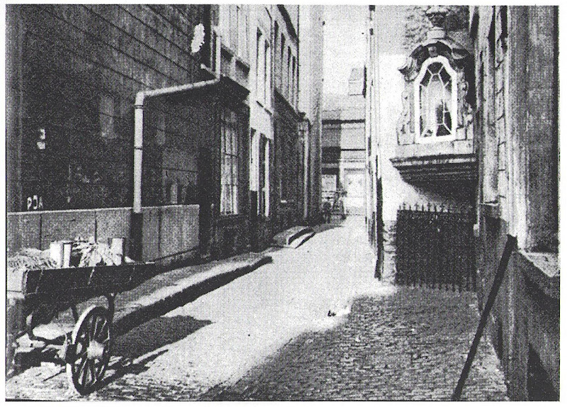
This old photo confirms that Jacques Carabain painted his watercolour of Rue du Chien Marin (see no. 22) with photographic accuracy.
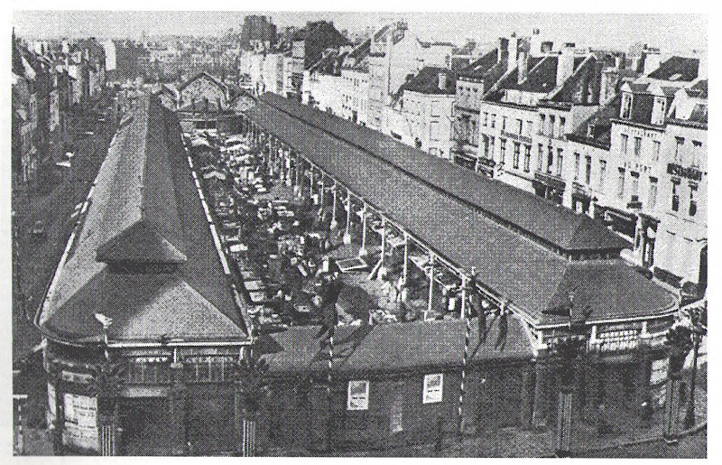
At the end of the old regime, the fish market was located on the site of the disused port on the Zenne, level with the modern-day Rue des Halles. Modernised in 1825-26, it disappeared when the Zenne was covered. Then, on the same site, the Brussels market halls were established and the fish market set up there. But the other traders weren't particularly happy being so close to the fish. In 1872, it moved temporarily to the Vieux-Marché-aux-Grains. Then, the eastern half of the Marchands basin was filled in so that a new fish market, constructed in 1882-1884, could be set up. It remained there until 1955.
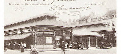
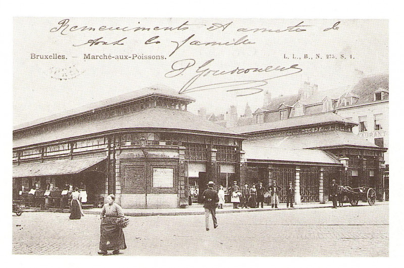
The fish market
This bird's eye view shows the fish market looking from east to west. The new Church of Sainte-Catherine, constructed on the site of the filled-in Sainte-Catherine basin, can be seen in the back of the photograph. In the background is half of the Marchands basin, which has not yet been filled in. On the right you will see the Quai au Bois à Brûler, and on the left the Quai aux Briques.
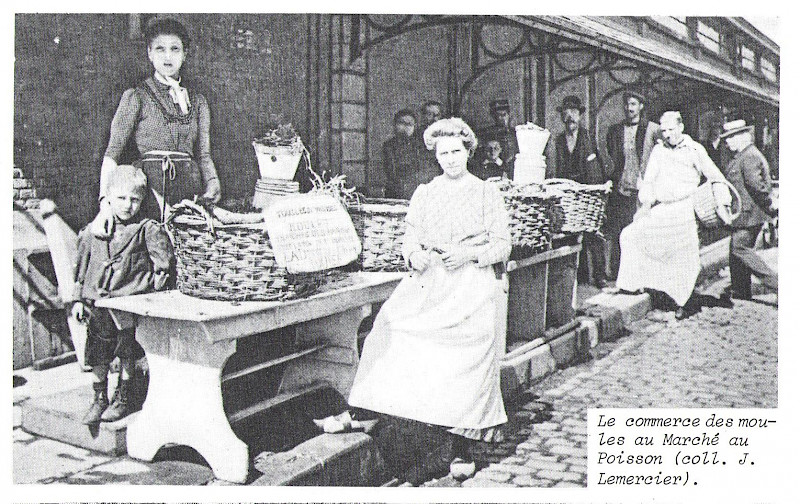
Inside the fish market
The old Flemish insult "viswijf" (which translates as cow; witch; dragon; gendarme; tart; harpy; bitch; gossip; bastard; nag; virago or shrew) is proof that women used to work as much as men. There were female fishmongers and they didn't have a particularly good reputation. Here, you can see them in the fish market, which operated here from 1884 to 1955.
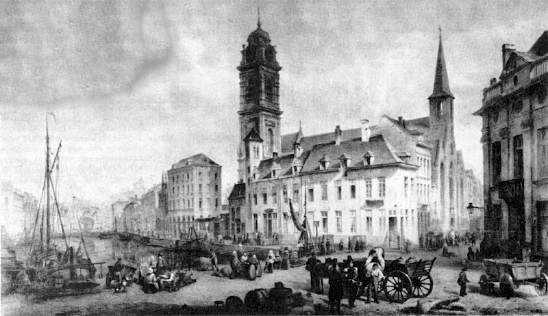
This painting by François Stroobant dates from 1886 and can be found in the mayor's office at the Town Hall. It shows the great crane (on the left), the tower of the old Church of Sainte-Catherine (in the centre) and the Vieux-Marché-aux-Grains (in the background). The house on the corner of Rue Sainte-Catherine and the Vieux-Marché-aux-Grains still stands, even if the ground floor no longer has its original appearance. The Sainte-Catherine basin, which would later disappear to make way for the new Church of Sainte-Catherine, is still there.
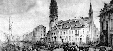
This 1839 painting by Henri Lallemand is housed in the collections of the Royal Museums of Fine Arts of Belgium on Rue de la Régence. The painter was stood in the Vieux-Marché-aux-Grains, looking north. On the left is the Sainte-Catherine basin and, in the background, the great crane. In the centre, the tower annexed to the chancel of the old Church of Sainte-Catherine. On the right, in Rue Sainte-Catherine, the front of the old church. When the new church was constructed in the filled-in Sainte-Catherine basin, it was decided to preserve the tower rather than construct a new one.
This splendid engraving shows the Convent of Jericho (or the Dames Blanches Convent) in the mid-17th century. The tree-lined square in front, at the bottom of the drawing, is the Vieux-Marché-aux-Grains. On the far right is the corner with Rue de Flandre. The two houses before the corner are still standing today, now a newsagent and a restaurant. Today, Rue Dansaert runs through the old orchard and the French garden in the middle of the engraving.
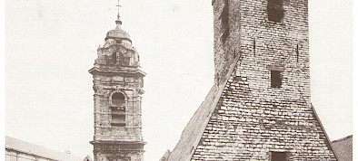
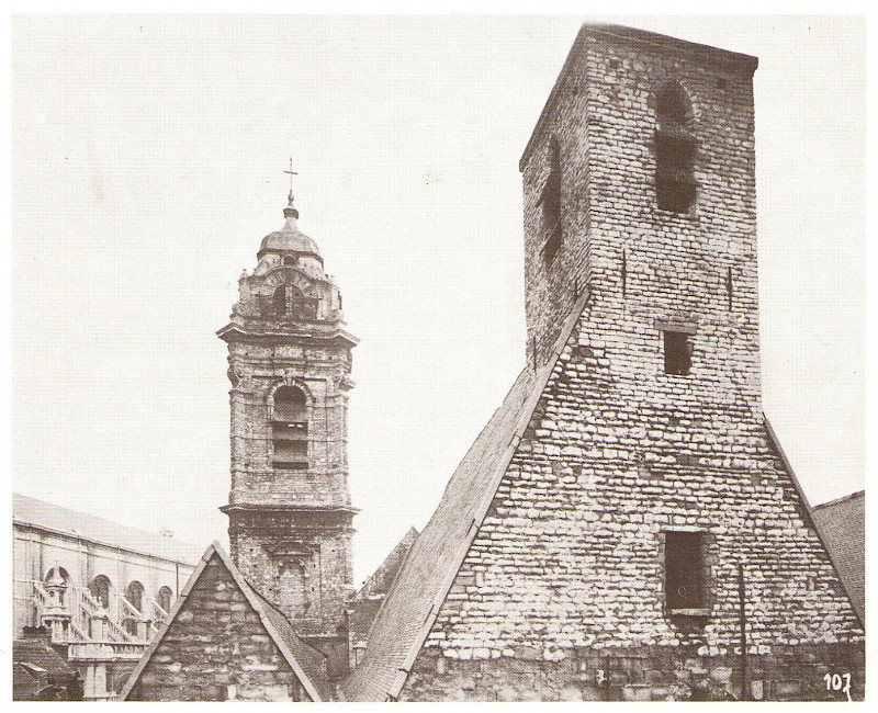
On the right, the old church tower that crowned its façade in Rue Sainte-Catherine. Behind that, the new tower, which was annexed to the chancel of the old church in the 17th century. In the back left, the roofs of the brand new 19th century church, constructed in the filled-in Sainte-Catherine basin. As the new 17th century tower was still in good condition when the new 19th century church was constructed, it was saved and still in use, meaning that a brand new tower was not needed.
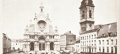
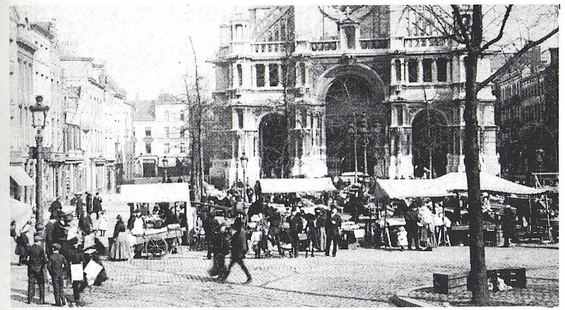
After the new Church of Sainte-Catherine was constructed, the market in front of the church became one of the most important sites in 19th century Brussels. After the Grand-Place, Place de la Bourse and Place de Brouckère, it is without doubt one of the most photographed, most painted locations of its time.
Sainte-Catherine Market
The market in Place Sainte-Catherine has perhaps lost some of its stature and appeal, but the terraces that now occupy part of the square are still charming.